Asadabad District (Asadābād)
Asadabad district is one of 15 districts in the Kunar Province of Afghanistan. It includes the city of Asadabad - the district center, close the Kunar River. It is situated in the central part of the province. It has 12 big and small villages, which are surrounded by mountains so there is not enough land for farming.
Before June 2004, Asadabad District bordered Dara-I-Pech District and Nuristan Province to the west, Bar Kunar, Dangam, Marawara and Sirkanay districts to the east and Narang wa Badil district to the south.
As of the 2004 Afghanistan administrative reorganization, Wata Pur District was spun off from Asadabad District, all of northeastern Asadabad District went to Dangam District and a small piece of eastern Narang District became western Asadabad District. The result was that Asadabad District borders on:
* Wata Pur District to the northwest,
* Dangam District to the northeast,
* Marawara District to the east and southeast,
* Sarkani District to the south, and
* Narang District to the west.
Map - Asadabad District (Asadābād)
Map
Country - Afghanistan
 |
 |
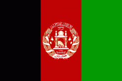
| Flag of Afghanistan | |
Human habitation in Afghanistan dates back to the Middle Paleolithic era, and the country's strategic location along the historic Silk Road has led it to being described, picturesquely, as the ‘roundabout of the ancient world’. Popularly referred to as the graveyard of empires, the land has historically been home to various peoples and has witnessed numerous military campaigns, including those by the Persians, Alexander the Great, the Maurya Empire, Arab Muslims, the Mongols, the British, the Soviet Union, and most recently by a US-led coalition. Afghanistan also served as the source from which the Greco-Bactrians and the Mughals, amongst others, rose to form major empires. The various conquests and periods in both the Iranian and Indian cultural spheres made the area a center for Zoroastrianism, Buddhism, Hinduism, and later Islam throughout history.
Currency / Language
| ISO | Currency | Symbol | Significant figures |
|---|---|---|---|
| AFN | Afghan afghani | Ø‹ | 2 |
| ISO | Language |
|---|---|
| PS | Pashto language |
| FA | Persian language |
| TK | Turkmen language |
| UZ | Uzbek language |


